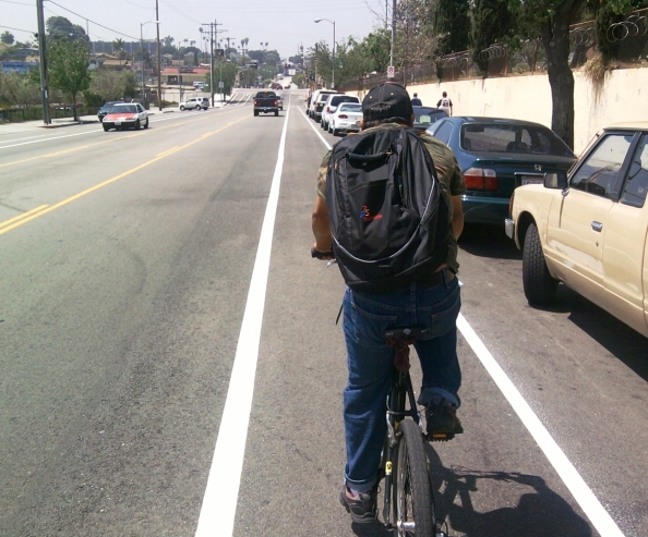
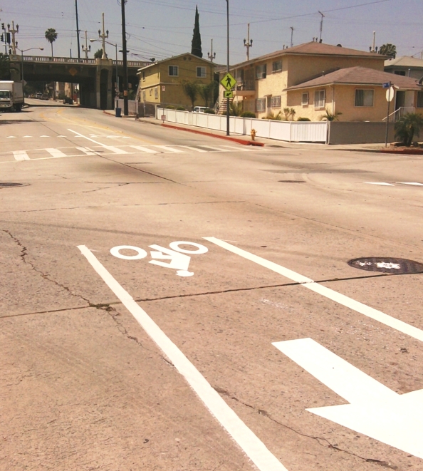
Thanks to Erick @elrandomhero Huerta for, via a Facebook post, alerting me to brand new bike lanes on Lorena Street in Boyle Heights. The new lanes were installed by the L.A. Dept. of Transportation (LADOT) last weekend – either May 19th or 20th 2012. They extend 0.4 miles on Lorena Street from Cesar Chavez Avenue to 3rd Street.
The lanes northern terminus is at “Cinco Puntos”: the 5-points intersection of Lorena, Chavez, and Indiana Street. Cinco Puntos is on the border between L.A. City’s Boyle Heights and unincorporated L.A. County’s East Los Angeles. The lanes run along the east edge of Evergreen Cemetery, the oldest burial ground in the city. Evergreen has the remains of early L.A. elected leadership, and segregated areas for Mexican, Japanese, and Armenian graves. In addition to what’s notable inside Evergreen, the site includes an innovative jogging path that runs on the sidewalk at its perimeter.
The bike lanes cross the Metro Gold Line tracks where they emerge from underground at the intersection of Lorena and First Street. At that location, the lanes connect with the First Street bike lanes, which feature green-pavement conflict zones. Also at this intersection is the notable El Mercado de Los Angeles – a sort of Mexican marketplace mall, featuring plenty of great restaurants, mariachis, and assorted stores selling Mexican wares. Of lesser fame, just south on Lorena, is what I think may be L.A.’s only combination bike-shop/hairdresser/halloween-costume establishment “C.A.C. Bike Shop.”
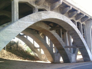
The lanes end at 3rd Street, a block before Lorena passes below the historic landmark 1928 4th Street Bridge (over Lorena Street and Bernal Street.) It’s a great old bridge, very similar to historic compound-arch concrete bridges over the L.A. River. The underside of this 4th Street Bridge is very accessible, so it’s a great place to see the ribbed compound arches up close.
I think that this is a very good bike lane project: a straightforward relatively-easy bike facility in a central neighborhood where folks really do bike (and walk) a lot, connecting with plenty of destinations – and following the city’s approved plans, hence a step toward a planned network.
Thanks LADOT, Mayor Villaragosa, and City Councilmember Jose Huizar for making these excellent Lorena Street lanes a reality!
This o.4 miles is the first phase of nearly two miles of bike lane for Lorena Street. The city Bike Plan designated 1.89 miles of Lorena Street from Cesar Chavez Avenue to Grande Vista Avenue. The city’s 5-Year Implementation Strategy scheduled the first 1.5 miles of the Lorena lanes (Cesar Chavez Avenue to 8th Street) to be implemented within five years of 2011.
Lorena Street narrows a bit under the historic bridge, so bike lanes become a somewhat tighter squeeze. I didn’t measure the actual street width, but I suspect that it could be a place where only the uphill direction receives a full bike lane, while cyclists going downhill would share a sharrowed lane. South of the bridge, it appears that a road diet may be needed to implement the bike lanes all the way to Grande Vista.


VW
05/22/2012
Particulates aside, that shady area under the 4th Street bridge would be a great place for a little neighborhood park/playground.
Joe Linton
05/22/2012
I agree. A couple years ago, I heard that Councilmember Huizar folks were working to create a small park there, but I don’t know what the status is on that project.